1861 Garrick Street Development Plan. Covent Garden St
1861 Garrick Street Development Plan. Covent Garden St. Martin's Lane – 1898 – Old map – Antique map – Vintage map – Printed maps of London
- .
- .
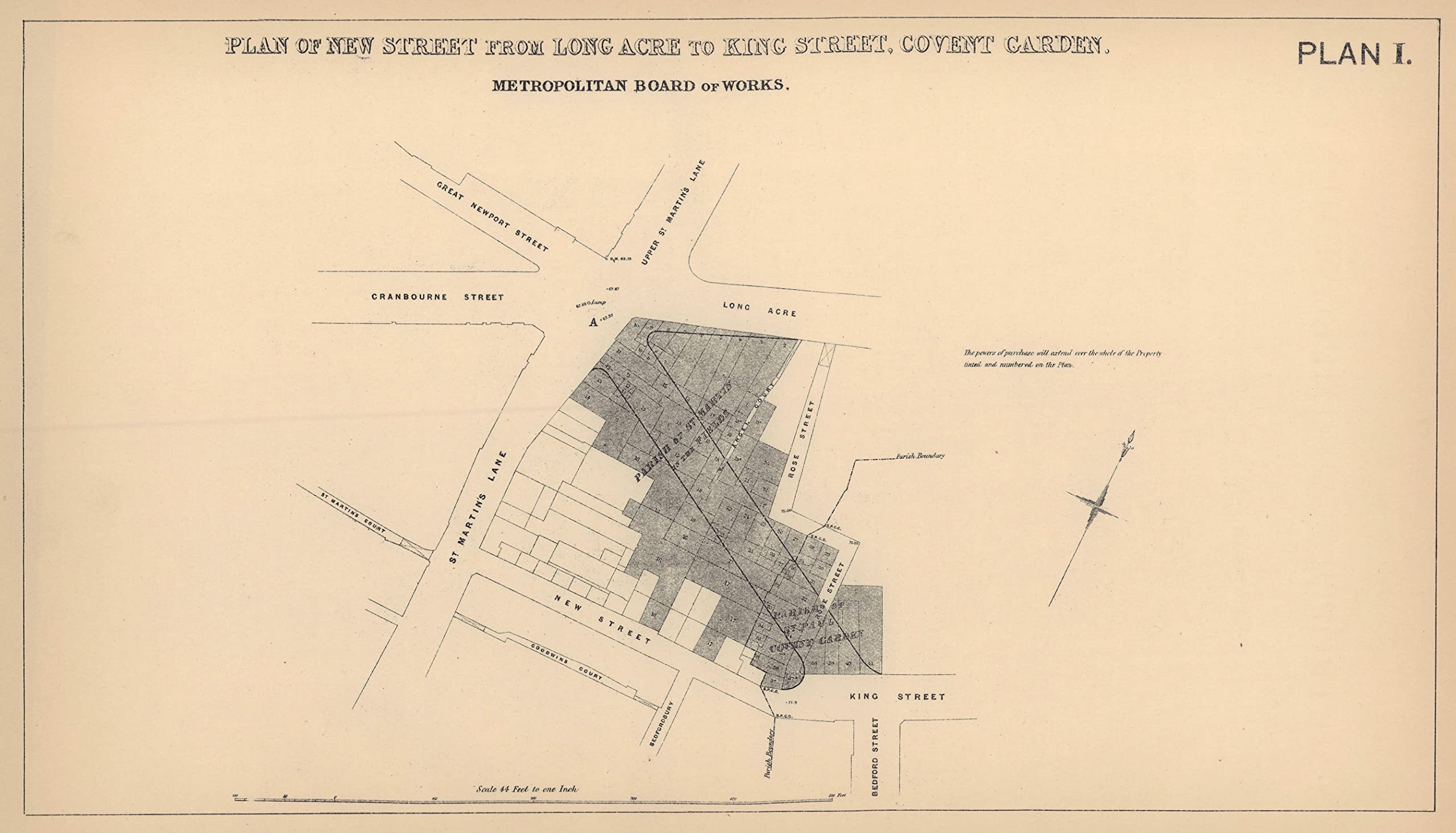
- Title: ‘Plan of New Street from Long acre to King street, Covent Garden – Metropolitan Board of Works. “Metropolitan Improvements” [ Covent Garden Approach (Garrick Street)]’
- Condition: Good; suitable for framing. Please check the scan for any blemishes prior to making your purchase.
- Size: 17.0 x 30.0cm, 6.75 x 11.75 inches (Medium)
- Type & Age: Year printed 1898. Antique map
- Verso: There is nothing printed on the reverse side, which is plain
Antique Map: 1861 Garrick Street development plan. Covent Garden St. Martin’s Lane. Title: ‘Plan of New Street from Long acre to King street, Covent Garden – Metropolitan Board of Works. “Metropolitan Improvements” [ Covent Garden Approach (Garrick Street)]’. Type: Antique map. Date of printing: 1898. Size: 17.0 x 30.0cm, 6.75 x 11.75 inches (Medium), 524 sq cm. Artist, cartographer or engraver: Percy Edwards. Condition: Good; suitable for framing. Please check the scan for any blemishes prior to making your purchase. Verso: There is nothing printed on the reverse side, which is plain. Provenance: “History of London Street Improvements”; By Percy J. Edwards, Published by P.S. King & Son, London. Subject categories: London Edwards P.
| SKU: | B09XFRKFMJ |
| Size: | 17.0 x 30.0cm, 6.75 x 11.75 inches (Medium) |
| Manufacture: | Shipping by airmail from UK: items normally reach US addresses within a few days but can take longer |
| Size: | 17.0 x 30.0cm, 6.75 x 11.75 inches (Medium) |